Here Goes Kenya is supported by its audience. We may earn an affiliate commission when you book an experience or hotel through links on our site. Learn More
The jewel in the crown of Central Kenya is Mount Kenya which, at 5,199m is Africa’s second-highest mountain and one of the top destinations to visit in Kenya. It is certainly a much more challenging and interesting climb than the ‘walk-up’ that is used to reach the summit of Africa’s highest peak, Mount Kilimanjaro. As a consequence of the glacial activity, there are several glacial lakes and tarns on Mount Kenya.
Over 30 lakes and tarns dot Mount Kenya’s varied landscape contrasting sharply with Mount Kilimanjaro. Whichever route you use when climbing the mountain, you can’t miss sighting a lake or a tarn. Here is a list of the largest lakes and tarns on Mount Kenya.
- Lake Alice
At 48 acres, Lake Alice is the largest crater lake on Mount Kenya. It is located near Ithangune hill, 3,400m above sea level. It was named after Princess Alice, Duchess of Gloucester, after visiting Kenya and attempting to climb the mountain only to reach 4,300m. The lake is stocked with trout making it perfect for sports fishing. Lake Alice is surrounded by exotic vegetation and offers scenic views for climbers.
- Lake Michaelson

Lake Michaelson is named after a friend of Halford Mackinder, a geographer and the first European explorer to summit Mount Kenya back in 1899. It is located in the Gorges Valley, above Vivienne falls just below the 300m cliff of the Temple beneath Mt.Kenya’s third highest peak, Point Lenana. The 30-acre lake is the second largest of the lakes and tarns on Mount Kenya.
Lake Michaelson is ideal for trout fishing. The surrounding icy peaks, magical waterfalls, and gorges provide pristine, breathtaking views.
- Lake Ellis
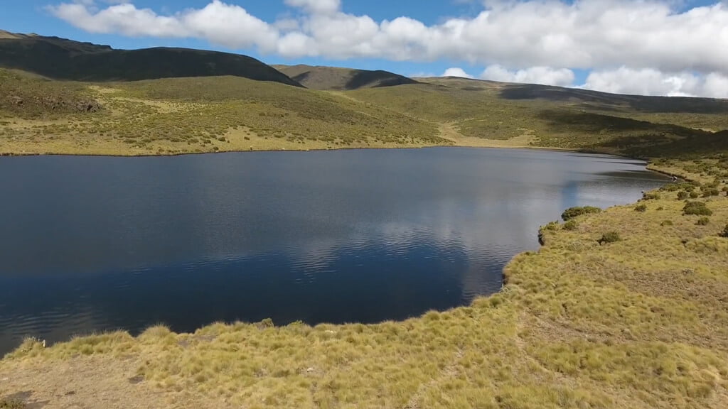
Lake Ellis was named after Thomas Evelyn Scott-Ellis, the first European to reach the lake in 1927, accompanied by Eric Dutton. The lake is located at the base of Mugi Hill, 3,470m above sea level. It is the furthest point you can drive to on the mountain. Lake Ellis offers stunning views of the peak and fresh, crisp air. The 28-acre beautiful lake is a popular fly fishing spot and stopover camp for climbers doing the Chogoria route.
- Lake Rutundu

Lake Rutundu got its name from the adjacent hill, Rutundu, which resembles packed tobacco in the Meru dialect. The lake is set off the beaten track on the northern slopes of Mount Kenya in an area of pure wilderness and breathtaking beauty. The 25-acre lake is the fourth largest of the lakes and tarns on Mount Kenya.
Lake Rutundu is ideal for anglers, hikers, campers, adventurers, and those looking for a tranquil mountain experience. Numerous rare bird species have found a home in the forest that flanks the lake, chiefly the delightful, scarlet-tufted malachite sunbird. Rutundu is also undeniably romantic for those on honeymoon. Did you know that it was here that UK’s Prince William proposed to Kate Middleton back in 2010?
- Lake Höhnel
At 21 acres, Lake Höhnel is the fifth largest of the lake and tarns on Mount Kenya. It was named after Lieut. Ludwig von Höhnel, who was the cartographer on Teleki’s expedition to Mount Kenya. The lake is 4,206m above sea level at the end of Hohnel valley, close to Teleki Tarn. The lake, which is dammed by moraine, is an ideal fishing spot.
- Carr Lakes
The 20-acre lakes sit at an elevation of 3,958m above sea level. They were named after Ernest Carr, who discovered the Carr Lakes and erected two huts on the mountain. The two masses are located in the lake-rich Hobley valley, just below Thompson tarn, Gallery tarn, Hanging tarn and the Enchanted Lake.
- Enchanted Lake
Enchanted is a stunning, serene, and hidden spot perfect for fly fishing whilst enjoying the alpine scenery and cool mountain air. The lake lies at an elevation of 4,350m above sea level, right in the Hobley valley just above Carr lakes. Enchanted Lake is the seventh largest of the lake and tarns on Mount Kenya, occupying 10 acres.
- Teleki Tarn

Teleki is a beautiful tarn located near Lake Höhnel in the Teleki Valley at 4,291m above sea level across the Rangers post near Shipton’s peak. It was named after Count Samuel Teleki, who led the first expedition to penetrate the forest zone of Mount Kenya in 1887.
Teleki Tarn, which occupies an area of 8.5 acres, was formed by glacial movement. Sometimes a leopard is seen in the surroundings and in between hiding in a cave above the lake.
- Hidden tarn

Hidden tarn is located in the pristine wilderness close to the Sommerfelt Peak at an elevation of 4,398m above sea level. It occupies an area of 7.8 acres.
- Hall tarns
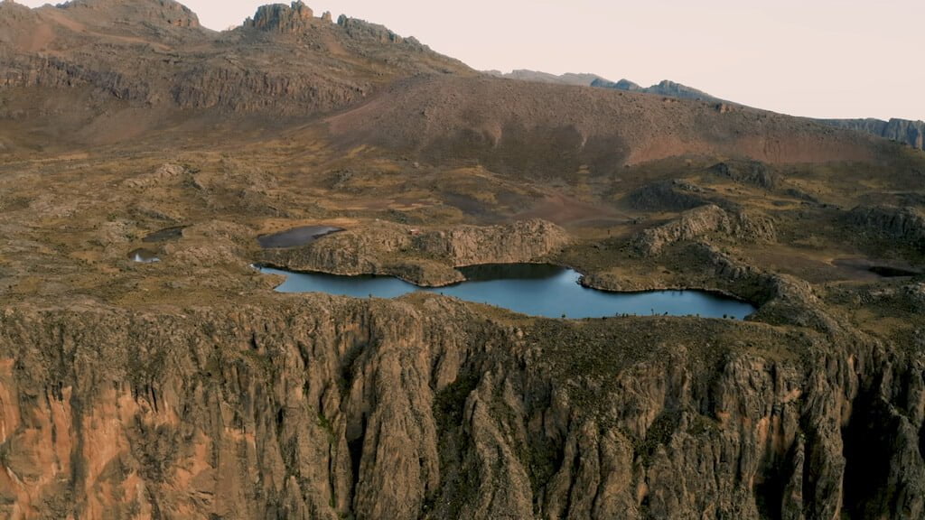
These are popular tarns sitting on a plateau above Lake Michaelson near Minto’s hut along the Chogoria route. The tarns sit on 5 acres at an elevation of 4,300m above sea level. They were named after F. G. Hall, the District Commissioner at then Fort Hall. A short 5-minute walk to the side of Hall Tarns provides a spectacular view of Lake Michaelson directly below.
